A new free online map is helping farmer groups across the UK find one another and explore the landscapes they work in.
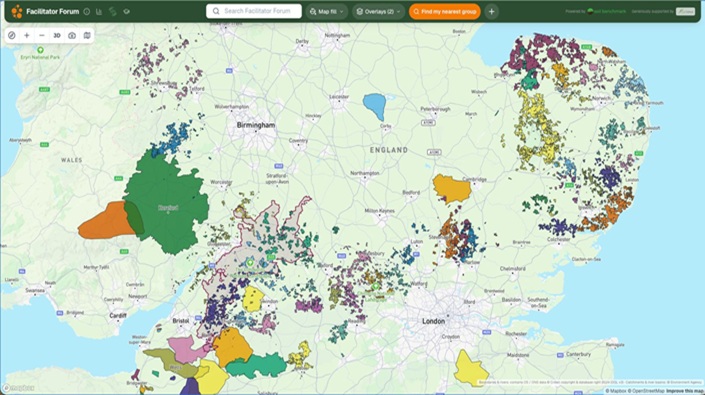
Launched by the Facilitator Forum, the map already shows 79 farmer groups. It brings groups together in one place alongside information about their local landscape, helping facilitators see who else is working nearby and make the case for farmer-led collaboration.
The map came directly out of the Facilitator Forum held at the Allerton Project in 2025, where facilitators asked for an easier way to see which other groups are out there and what surrounds them. Facilitators have been using the map and helping shape it since it was first shared with them at Groundswell in July.
Clicking on any group shows its area alongside catchments, local authorities, designations, soils and land grade, why local rivers are failing to reach good status, and the population and economic activity downstream. Groups can use this as evidence when talking to funders, water companies and other partners. No mapping experience is needed to take part.
Boundaries are merged so no individual farm is ever shown, and groups can choose to show just the rough area they work in. The map is completely independent: it is hosted separately from any company, and group boundaries go nowhere other than onto the map.
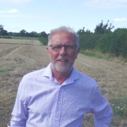
Tom Scrope, co-chair of the Facilitator Forum, said: “Travelling for my Nuffield Scholarship, the one thing that kept coming up as driving change on farms was a well-run farmer group with a good facilitator. The countries with lots of groups had networks behind them, helping facilitators learn from each other. This map is a first step towards that here – a simple way for groups to find each other, and to show funders and water companies the landscape they’re working in.”
To explain how the map works, a webinar is being held on 29th October. To register your interest, click here.